
1. Definiție tehnică și funcții de bază
Senzorul de sol este un dispozitiv inteligent care monitorizează parametrii de mediu ai solului în timp real prin metode fizice sau chimice. Dimensiunile sale principale de monitorizare includ:
Monitorizarea apei: Conținut volumetric de apă (VWC), potențial matriceal (kPa)
Proprietăți fizice și chimice: Conductivitate electrică (EC), pH, potențial REDOX (ORP)
Analiza nutrienților: conținut de azot, fosfor și potasiu (NPK), concentrația de materie organică
Parametri termodinamici: profilul temperaturii solului (măsurarea gradientului 0-100 cm)
Indicatori biologici: Activitate microbiană (rata respiratorie cu CO₂)
În al doilea rând, analiza tehnologiei de detectare mainstream
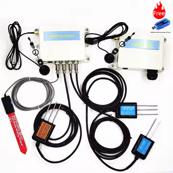
Senzor de umiditate
Tip TDR (reflectometrie în domeniul timpului): măsurarea timpului de propagare a undelor electromagnetice (precizie ±1%, interval 0-100%)
Tip FDR (reflexie în domeniul frecvenței): Detecție permitivitate condensator (cost redus, necesită calibrare regulată)
Sondă neutronică: Numărătoare de neutroni moderată de hidrogen (precizie de nivel de laborator, este necesar un permis de radiații)
Sondă compozită multiparametrică
Senzor 5 în 1: Umiditate +EC + temperatură +pH + Azot (protecție IP68, rezistență la coroziune salină-alcalină)
Senzor spectroscopic: Detecție in situ în infraroșu apropiat (NIR) a materiei organice (limită de detecție 0,5%)
Nouă descoperire tehnologică
Electrod cu nanotuburi de carbon: rezoluție de măsurare EC de până la 1 μS/cm
Cip microfluidic: 30 de secunde pentru a finaliza detectarea rapidă a azotului nitrați
În al treilea rând, scenarii de aplicații industriale și valoarea datelor
1. Management precis al agriculturii inteligente (câmp de porumb din Iowa, SUA)
Schema de implementare:
O stație de monitorizare a profilului la fiecare 10 hectare (20/50/100 cm pe trei niveluri)
Rețea wireless (LoRaWAN, distanță de transmisie 3 km)
Decizie inteligentă:
Declanșator de irigare: Porniți irigarea prin picurare când VWC <18% la o adâncime de 40 cm
Fertilizare variabilă: Ajustarea dinamică a aplicării azotului pe baza diferenței valorii EC de ±20%
Date despre beneficii:
Economie de apă cu 28%, creștere a ratei de utilizare a azotului cu 35%
O creștere de 0,8 tone de porumb pe hectar
2. Monitorizarea controlului deșertificării (Proiectul de restaurare ecologică a zonei Sahara Fringe)
Matrice de senzori:
Monitorizarea pânzei freatice (piezorezistivă, interval 0-10 MPa)
Urmărirea frontului de sare (sondă EC de înaltă densitate cu spațiere a electrozilor de 1 mm)
Model de avertizare timpurie:
Indicele de deșertificare =0,4×(EC>4dS/m)+0,3×(materie organică <0,6%)+0,3×(conținut de apă <5%)
Efectul guvernanței:
Acoperirea cu vegetație a crescut de la 12% la 37%
Reducere cu 62% a salinității de suprafață
3. Avertizare de dezastru geologic (Prefectura Shizuoka, Rețeaua de monitorizare a alunecărilor de teren din Japonia)
Sistem de monitorizare:
Pantă interioară: senzor de presiune a apei în pori (interval 0-200kPa)
Deplasare la suprafață: dipmetru MEMS (rezoluție 0,001°)
Algoritm de avertizare timpurie:
Precipitații critice: saturație a solului >85% și precipitații orare >30 mm
Rată de deplasare: 3 ore consecutive >5 mm/h declanșează alarma roșie
Rezultatele implementării:
Trei alunecări de teren au fost avertizate cu succes în 2021
Timpul de răspuns la situații de urgență redus la 15 minute
4. Remedierea siturilor contaminate (Tratarea metalelor grele în Zona Industrială Ruhr, Germania)
Schema de detectare:
Senzor de fluorescență XRF: Detecție in situ a plumbului/cadmiului/arsenicului (precizie ppm)
Lanțul potențial REDOX: Monitorizarea proceselor de bioremediere
Control inteligent:
Fitoremedierea este activată atunci când concentrația de arsen scade sub 50 ppm
Când potențialul este >200mV, injectarea donorului de electroni promovează degradarea microbiană.
Date privind guvernanța:
Poluarea cu plumb a fost redusă cu 92%
Ciclul de reparare redus cu 40%
4. Tendința evoluției tehnologice
Miniaturizare și matrice
Senzorii cu nanofire (diametru <100 nm) permit monitorizarea zonei radiculare a unei singure plante
Piele electronică flexibilă (elasticitate 300%) SE ADAPTEAZĂ la deformarea solului
Fuziunea perceptivă multimodală
Inversia texturii solului prin unde acustice și conductivitate electrică
Măsurarea conductivității apei prin metoda impulsului termic (precizie ±5%)
IA promovează analize inteligente
Rețelele neuronale convoluționale identifică tipurile de sol (precizie de 98%)
Gemenii digitali simulează migrarea nutrienților
5. Cazuri tipice de aplicare: Proiectul de protecție a zonei negre din nord-estul Chinei
Rețea de monitorizare:
100.000 de seturi de senzori acoperă 5 milioane de acri de teren agricol
A fost creată o bază de date 3D a „umidității, fertilității și compactității” în stratul de sol de 0-50 cm.
Politica de protecție:
Când materia organică <3%, întoarcerea paielor în profunzime este obligatorie
Densitatea volumetrică a solului >1,35 g/cm³ declanșează operațiunea de subsolare
Rezultatele implementării:
Rata de pierdere a stratului de sol negru a scăzut cu 76%
Randamentul mediu de soia pe mu a crescut cu 21%
Stocarea carbonului a crescut cu 0,8 tone/ha pe an
Concluzie
De la „agricultura empirică” la „agricultura datelor”, senzorii de sol remodelează modul în care oamenii comunică cu pământul. Prin integrarea profundă a procesului MEMS și a tehnologiei Internet of Things, monitorizarea solului va realiza progrese în rezoluția spațială la nanoscală și răspunsul în timp la nivel de minut în viitor. Ca răspuns la provocări precum securitatea alimentară globală și degradarea ecologică, aceste „santinele silențioase” îngropate adânc vor continua să ofere suport cheie pentru date și vor promova gestionarea și controlul inteligent al sistemelor de la suprafața Pământului.
Data publicării: 17 februarie 2025